Summary:
Captaincy of the Port of Funchal updates on severe weather warnings
Warnings valid until 6 PM tomorrow, March 18
Winds expected to reach up to 74 km/h
North Coast waves up to 7 meters
Public advised to avoid coastal activities during this period
Weather Advisory Update
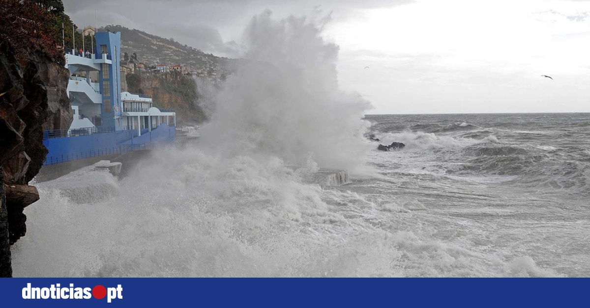
The Captaincy of the Port of Funchal has issued an update regarding strong winds and high sea conditions for the coastal areas of the Madeira archipelago. These warnings will be in effect until 6 PM tomorrow, March 18.
Forecast Details
The advisories are based on forecasts from the Portuguese Institute of the Sea and Atmosphere (IPMA) regarding the general weather conditions (wind and sea).
According to the IPMA, winds will blow from the Northwest ranging from 31 to 38 km/h (fresh) to 40 to 50 km/h (very fresh), occasionally reaching 62 to 74 km/h (very strong) at the beginning.
Visibility is expected to be good to moderate, at times weak.
Wave Conditions
On the North Coast, waves will be from the Northwest, measuring 5 to 7 meters, decreasing to 2.5 to 3.5 meters. On the South Coast, waves will be from the West/Southwest measuring 4 to 5 meters, and 3 to 4 meters on the East side.
Safety Recommendations
In light of these predictions, the Captaincy recommends:
- Reinforcing the mooring of vessels and maintaining close monitoring of docked and anchored boats.
- The general public should avoid walks near the sea or in areas exposed to maritime agitation, such as harbor breakwaters, cliffs, or beaches, to prevent being caught off guard by waves.
- It is also advised against engaging in recreational fishing, especially near cliffs and areas frequently impacted by wave action, as the sea can easily reach seemingly safe zones under these conditions.


Comments
Join Our Community
Create an account to share your thoughts, engage with others, and be part of our growing community.